THINKING: housing research
A Shift in the City’s Fabric: Understanding San Francisco’s New Family Zoning Plan
San Francisco’s newly adopted Family Zoning Plan marks a major shift in how the city thinks about growth, equity, and access to opportunity. For decades, housing development has been concentrated in the city’s eastern neighborhoods — SoMa, the Mission, Dogpatch — where zoning allowed for larger-scale projects. Meanwhile, the western and northern parts of the city remained largely unchanged, shielded by single-family zoning that limited the kinds of housing that could be built and who could afford to live there. The Family Zoning Plan also addresses San Francisco’s requirement to update the city’s zoning to provide enough housing capacity to meet the city’s housing element – a state-mandated process that ensures jurisdictions across the state are planning for growth.
This uneven development pattern hasn’t just shaped the city’s skyline — it’s deepened economic and racial segregation, concentrated new infrastructure investment in a few areas, and left much of the city off-limits to middle- and working-class families. The Family Zoning Plan begins to address that imbalance by allowing more housing options in neighborhoods with strong access to schools, parks, transit, and other resources that support healthy, connected communities.
Passed this week by a 7–4 vote of the San Francisco Board of Supervisors, the Family Zoning Plan was introduced by Mayor Daniel Lurie as one of his administration’s first major housing efforts. What follows is a breakdown of what the plan changes and what it could mean for the future shape of San Francisco’s neighborhoods.
How the Family Zoning Plan Reshapes San Francisco’s Neighborhoods
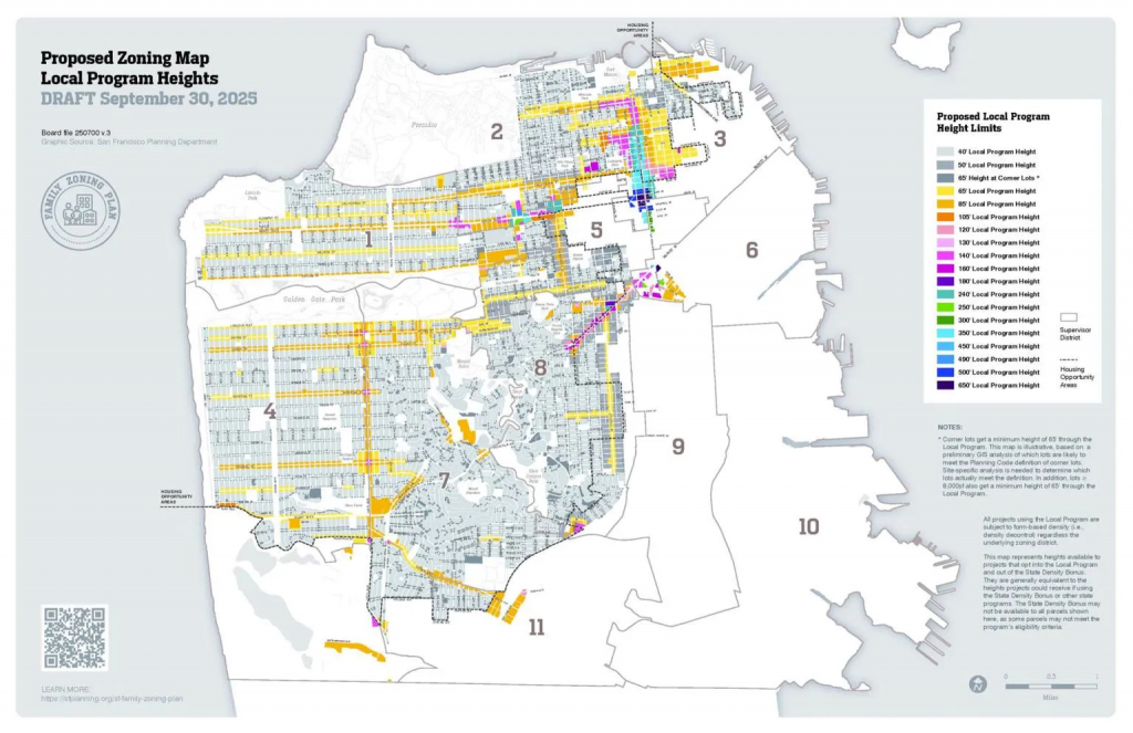
The Family Zoning Plan introduces one of the most sweeping changes to San Francisco’s residential landscape in decades, rezoning roughly sixty percent of the city — largely the west-side and northern neighborhoods long dominated by single-family homes. These areas, despite strong access to parks, schools, transit, and services, have seen relatively little housing growth for generations.
What the new zoning framework allows:
- End of single-family-only zoning across the city’s low-density districts.
- Up to four homes by right on most residential lots.
- Up to six homes when two units are deed-restricted affordable housing.
- Removal of density limits, shifting regulation toward height, setbacks, and form rather than unit count.
- Objective, streamlined approvals, with qualifying projects moving forward without discretionary review.
- Corridors have been upzoned to accommodate larger residential buildings by allowing significantly taller heights. These corridors are typically served by higher levels of transit service and existing commercial uses.
By extending these changes across such a large share of the city’s residential neighborhoods, the plan fundamentally rebalances where housing can be built — opening up parts of the city that have been effectively off-limits to new homes for decades.
How the Family Zoning Plan Works on Larger Sites where Taller Buildings are Allowed
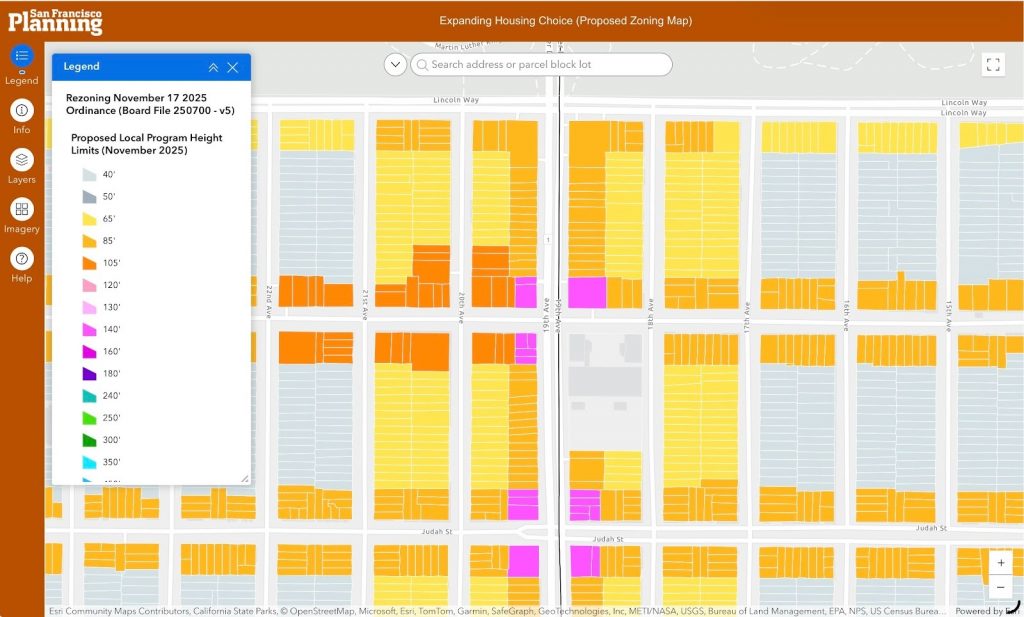
This snip of the interactive zoning map highlights some of the core strategies behind the height changes. At the center, the intersection of 19th Avenue and Irving Street receives new 70’/140’ height limits (shown in purple). This reflects its wider road width, existing commercial activity, and strong transit access — with multiple routes along 19th Avenue, buses on Lincoln one block north, and light rail on Judah one block south. The surrounding corridors and adjacent blocks are also upzoned, though to more moderate maximum heights in the 65’–105’ range.
Previously, this intersection was limited to 40 feet, which allowed housing but made redevelopment unlikely to pencil financially, especially where active commercial uses remain. (For example, the northeast corner is currently a gas station.) Under the new framework, sites can utilize either a 70-foot base height or a 140-foot Local Program height, depending on which regulatory path a project chooses.
What is the difference between the base height and the local program height?
Per the Planning Department:
“Projects that use the Local Program must meet all Planning Code requirements, including height limits and Citywide Design Standards, and must opt out of the State Density Bonus and other state programs that offer additional height or density above what’s allowed under City mi codes. In exchange, projects receive code flexibility on a variety of topics, meant to be on par with (or sometimes even more flexible than) what can be sought under the State Density Bonus.”
For sites shown in the map above, a developer effectively has two pathways:
- Develop the site using the base height of 70’ and the standard Planning Code requirements and then apply for additional height using the state density bonus law to obtain additional height/density. Concessions and incentives would be available based on the number of affordable units provided.
- Develop the site using the local program with a 140’ height limit, which would require following the rules of this program, and the legislative digest for the zoning amendments offers info about the requirements. One of the attractive items to developers is that the local program offers more flexibility on inclusionary affordable housing: state density bonus projects would be required to put these units on site, but there is an off-site option in the local program and it offers some projects a rent control option in lieu of below market rate rents. The overall project density between the local and state density bonus options will likely work out to a similar number if the project sponsor elects to max out the density bonus option (although this can vary based on site conditions and other constraints).
Ministerial processing of permits is still available through SB35/SB423 which significantly improves permit processing timelines. For more information about this opportunity to streamline approvals, please refer to the SF Planning Department.
Implementation and What Comes Next (Single Stair Buildings, Hopefully)
With the Family Zoning Plan now adopted, San Francisco enters the implementation phase of its Housing Element rezoning commitments. State law requires the city to bring its zoning into alignment with its long-range housing goals, and this plan represents one of the first major steps in that multi-year process. The new zoning will take effect in January, ahead of the January 31, 2026 deadline set by the State of California.
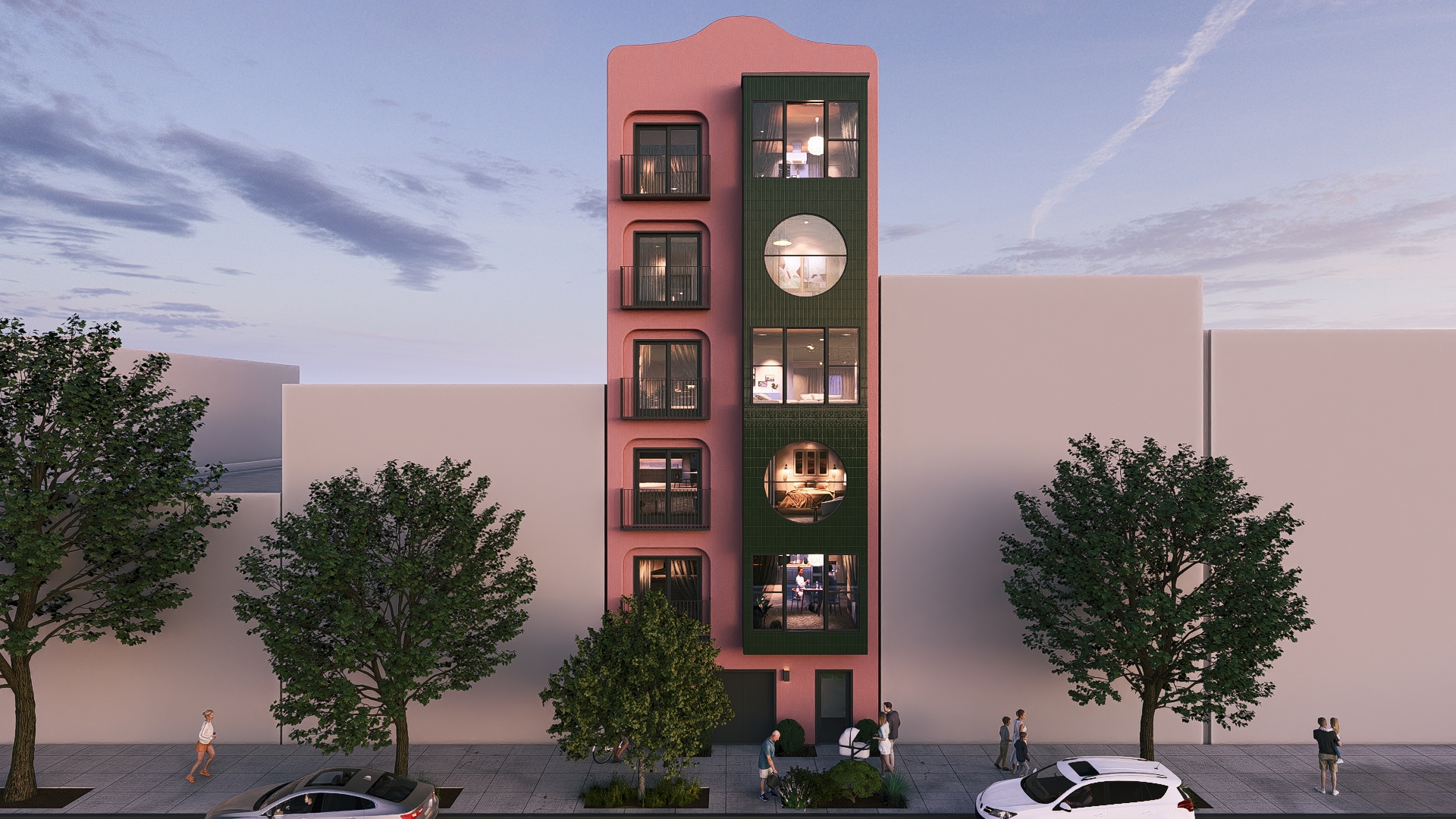
OpenScope hopes that San Francisco’s elected officials will now look at other ways to increase housing production, specifically through reforming the building code to allow Single Stair Buildings. This would make the small sites options in the Family Zoning Plan much more feasible to design and develop, similar to building code reforms made in Seattle, Los Angeles and most countries outside of the U.S.
Moving Towards a More Connected, Inclusive San Francisco
The Family Zoning Plan doesn’t remake San Francisco overnight but is another step in fostering a new pattern of growth. Over the last 10 years there have been a series of major policy changes ranging from statewide Accessory Dwelling Unit regulations to a statewide Transit Oriented Development framework that have made it easier and predictable to build homes. The Family Zoning Plan continues the work that began decades ago with the Eastern Neighborhoods Plan and the Market Octavia Plan and expands the opportunity to build additional homes to the rest of the City.
For designers and developers, this moment widens the field of what’s possible: more sites, more flexibility, and more opportunities to reimagine familiar residential forms for the needs of today’s families. At OpenScope, we look forward to working with partners across the city to translate this new zoning framework into thoughtful, well-designed homes that strengthen communities and support a more inclusive future for San Francisco. Contact us if you have questions about what’s possible on your site.